Boundary line disputes in southern Vermont: what's at stake for Current Use
Your property boundary is not just a legal abstraction - it is the foundation every Current Use benefit rests on, and when that foundation is fuzzy, everything above it is at risk.
Vermont's Use Value Appraisal program, known universally as Current Use, taxes enrolled forestland at its value for growing timber rather than at its speculative development value. For landowners in Newfane, Townshend, Jamaica, Grafton, and the rest of Windham County, that difference can mean hundreds or even thousands of dollars less in annual property taxes. But the program comes with obligations, and one that gets underestimated again and again is the requirement that enrolled acreage be accurately described and clearly distinguished from any land that is not enrolled. Boundary uncertainty puts that distinction in jeopardy.
Why boundary lines erode over time
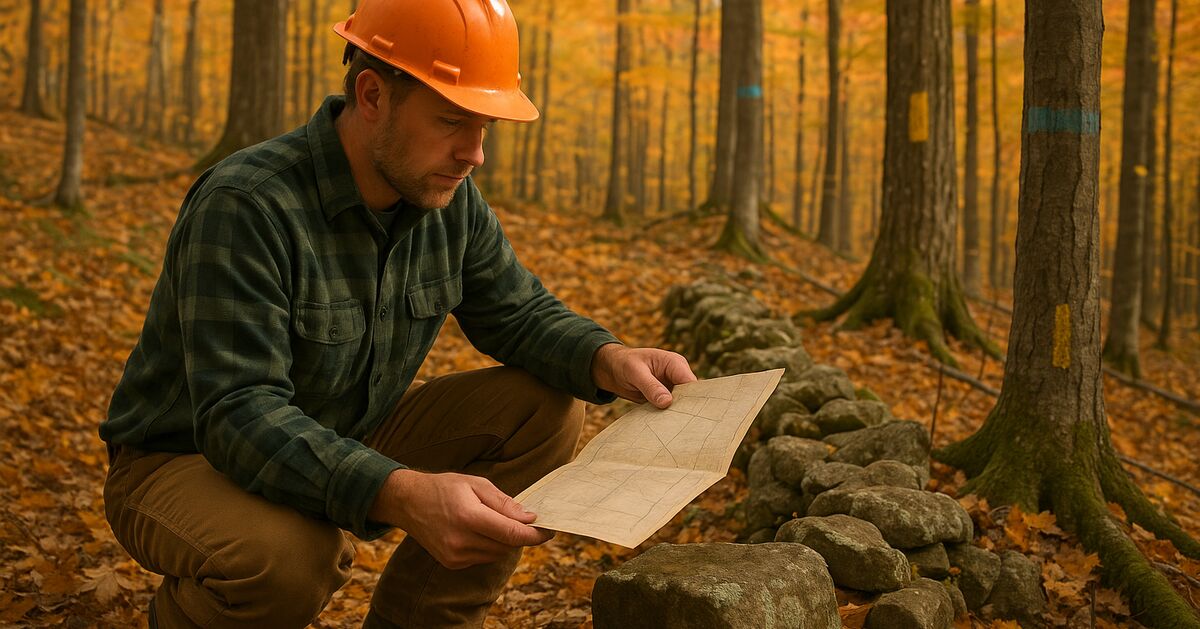
Southern Vermont's forested landscape is old, layered, and legally complicated. Many parcels were surveyed in the eighteenth or nineteenth century using stone walls, witness trees, and hand-drawn metes-and-bounds descriptions that bear little resemblance to what you can actually find on the ground today. Witness trees rot. Stone walls get pushed around by frost, logging equipment, or well-meaning neighbors clearing brush. Iron pins corrode or get moved. In a town like Halifax or Windham, where parcels may not have changed hands in a generation, the paper description in the deed and the physical reality in the woods can drift apart by dozens of feet - sometimes more.
That drift is not merely a surveying inconvenience. It has direct consequences for how your land is managed, how a timber harvest is conducted, and whether the acreage your town has enrolled in Current Use matches the acreage you actually own and manage.
What Vermont's Current Use program requires
Vermont's Current Use program is administered by the Department of Taxes, with the forest management side governed by the Department of Forests, Parks and Recreation. Enrolled forestland must be managed under an approved forest management plan written by a licensed consulting forester. That plan describes the parcel - its boundaries, its acreage, its forest types, and the management activities planned for it.
When a forest management plan is written for land with uncertain boundaries, the forester has to make assumptions. If those assumptions turn out to be wrong - because a disputed line was actually ten acres to the east of where everyone thought it was - the enrolled acreage could be overstated. Overstating enrolled acreage is a problem. It can trigger a review by the Department of Taxes, require a corrected enrollment, and in serious cases, result in back taxes and penalties on acreage that was never legitimately enrolled.
The inverse problem is also real: a boundary dispute that causes you to under-enroll acreage you legitimately own means you are paying full development-rate taxes on land that should be getting the use-value benefit. Either way, you lose.
For a plain-language overview of how the program works and what it demands of landowners, our frequently asked questions page is a good starting point, and our consulting and forest management services page explains how we help owners get and stay enrolled correctly.
The neighbor problem: encroachment and Current Use
A boundary dispute with a neighbor creates a specific kind of risk that many landowners in Athens, Brookline, and Guilford do not see coming. If a neighbor has been using a strip of your enrolled forestland - grazing livestock, mowing it, or treating it as their yard - that land may no longer qualify as forestland under the program's definitions. Current Use forestland must actually be managed as forestland. Land that has been effectively converted to another use by a neighbor's encroachment can be found non-compliant.
Vermont's doctrine of adverse possession is also worth understanding, even if you never end up in a courtroom. Vermont's adverse possession doctrine is generally understood to require open, notorious, continuous, and hostile use of another's land for a statutory period before a legal ownership claim can arise; consult an attorney for specifics. If a boundary line has been functionally ignored for a long time, and your neighbor has been treating a strip of your enrolled land as their own, you may face a real title challenge. Losing that acreage mid-enrollment cycle is the kind of event that forces a corrected map, a revised management plan, and potentially a land use change tax event on the disputed strip.
You can read more about how the land use change tax works and what triggers it in our detailed post on Vermont's land use change tax.
Timber harvests make boundary problems urgent
A boundary dispute that simmers quietly for years can explode the moment a timber harvest begins. When a logger takes trees, it is the landowner's responsibility - not the logger's - to ensure that harvesting stays within the property. Vermont's logging regulations, enforced through the Agency of Natural Resources, hold landowners accountable for what happens on their land. Cutting timber across a disputed line, even accidentally, may expose a landowner to a trespass claim, a demand for enhanced stumpage payment, and potential civil litigation, depending on the circumstances.
Beyond the legal exposure, a timber trespass incident could lead the Department of Taxes to pause or review your Current Use enrollment while the dispute is resolved. Depending on how long the resolution takes and how the Department of Taxes views the situation, you could face penalties and back taxes. It is the kind of cascading problem that a licensed consulting forester tries to anticipate and prevent before a single tree is cut. Our post on landowner liability, logging contracts, and forester roles goes into that relationship in much more detail.
What "marked" really means in a Vermont forest
Marking a boundary line in a working Vermont forest means more than knowing roughly where the line is. A properly marked line is one that a logger, a neighbor, or a state inspector can find and follow without having to guess. That typically means:
- Blazed or painted trees along the line at intervals close enough to maintain a clear sight line through the canopy
- Posted corners with surveyors' stakes, iron pins, or other monumented evidence
- A recorded survey plat that matches what is on the ground
- Consistent line marking refreshed after harvests or other disturbances
The Vermont Forests, Parks and Recreation department encourages landowners to work with licensed foresters to locate and mark lines before any management activity begins. If your forester cannot reliably locate a corner or line, that is a signal - not a minor annoyance - that a licensed land surveyor needs to be involved before the management plan is finalized.
The difference between a forester and a surveyor
A common source of confusion for landowners across our service area is the difference between what a consulting forester does and what a licensed land surveyor does. These are two distinct professions with different scopes of practice, and you may need both.
A consulting forester reads the land - its timber, its wildlife habitat, its drainage, its forest health - and writes the management plan that satisfies Current Use requirements. Foresters are trained to locate and follow boundary lines in the field using deeds, old surveys, and physical evidence. But a forester cannot establish a legal boundary; only a licensed land surveyor can do that.
If there is a genuine dispute about where a line is, or if the existing evidence on the ground is too ambiguous to rely on, the right step is to hire a licensed Vermont land surveyor to conduct a boundary survey and, where needed, file a survey plat in the town land records. Once that survey exists, your forester can write or update the management plan with confidence, and your enrollment rests on a solid legal description.
Our locations page can help you understand the areas we serve, and we work closely with surveyors throughout Windham County to make sure the forestry side and the survey side of a project are coordinated.
What to do if you suspect a boundary problem
If you have any reason to think your boundary lines are uncertain - a neighbor has commented on where they think the line is, you cannot find corner markers, the deed description uses trees that no longer exist, or you simply have not looked at the lines in years - here is a reasonable sequence of steps:
- Pull your deed and any existing surveys from the town clerk's office. Read the description and note any references to physical monuments you can try to locate.
- Walk the line with your consulting forester. An experienced forester who knows the area can often find old evidence that confirms or challenges the deed description.
- If the evidence is unclear or a neighbor is contesting the line, engage a licensed Vermont land surveyor. Do this before any timber harvest and before renewing or submitting a forest management plan.
- Once the survey is complete, make sure your management plan reflects the accurate, surveyed boundary and that the enrolled acreage in the Department of Taxes records matches.
- Mark the lines physically in the woods. Paint or blaze them at a frequency that a logger can follow, and refresh the marking every few years or after any activity near the line.
In Marlboro, Wardsboro, and Dummerston - towns where forested parcels often share long, irregular boundaries with multiple neighbors - this kind of proactive boundary work is especially valuable. A modest investment in a survey and fresh line marking now is cheap compared to the cost of a trespass dispute, a tax penalty, or an enrollment correction after the fact.
How boundary clarity supports better forest management
There is a reason we raise boundary issues in the same breath as forest management plans and Current Use enrollment. Good forest stewardship - the kind that builds long-term timber value, improves wildlife habitat, and keeps your land in the program - is only possible when you know exactly what land you are managing. A management plan written over uncertain boundaries may prescribe timber work in the wrong stand, miss a sensitive drainage area just over the line, or fail to account for easements or encumbrances that affect what management is legally permissible.
Clear boundaries also make it easier to coordinate with neighbors on shared concerns like invasive species management, deer browse pressure, or shared logging road access. In a tight-knit Windham County community, a friendly, documented boundary agreement is far preferable to a dispute that poisons a neighbor relationship for decades.
For a deeper look at how thoughtful stewardship connects to the program's long-term benefits, see our post on forest stewardship, timber value, and wildlife in southern Vermont.
Don't wait for a dispute to find you
The time to address a boundary question is when your land is quiet - not in the middle of a harvest, not when a neighbor has just put up a fence ten feet inside your property, and not when the Department of Taxes is reviewing your enrollment. If you are in the Current Use program, or thinking about enrolling, boundary line clarity is one of the first things worth confirming.
Our team works with landowners across Newfane, Townshend, Jamaica, and the broader region to write forest management plans that reflect accurate, defensible boundaries - and to flag situations where a surveyor should be brought in before the plan is finalized. Reach out through our contact page to talk through where your land stands and what steps make sense for your situation.
A clear line in the woods is not a bureaucratic formality. It is the thing that keeps your tax benefit secure, your harvest legal, and your relationship with your neighbors on solid ground.
Sources & further reading
- Vermont Use Value Appraisal (Current Use) Program overview (Vermont Department of Taxes)
Revision history (1)
- Sep 2, 2026 - Pre-publish editorial QA: clean; claim audit: 5 claims, 3 rewritten
Claim-by-claim audit (5 checked)
- “Vermont's adverse possession doctrine is generally understood to require open, notorious, continuous, and hostile use of another's land for a statutory period before a legal owners…” (rewritten to what the article can stand behind)
- “Cutting timber across a disputed line, even accidentally, may expose a landowner to a trespass claim, a demand for enhanced stumpage payment, and potential civil litigation, depend…” (rewritten to what the article can stand behind)
- “Overstating enrolled acreage is a problem. It can trigger a review by the Department of Taxes, require a corrected enrollment, and in serious cases, result in back taxes and penalt…” (reasoning shown in the article)
- “Beyond the legal exposure, a timber trespass incident could lead the Department of Taxes to pause or review your Current Use enrollment while the dispute is resolved.” (rewritten to what the article can stand behind)
- “Land that has been effectively converted to another use by a neighbor's encroachment can be found non-compliant.” (reasoning shown in the article)
Talk to a forester
Tell us about the land
Town, rough acreage, and whether the parcel is already enrolled. If you are working to a filing deadline, say which one and we will tell you honestly whether it is achievable.