
Forestry Services in Windham County
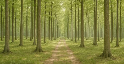
Vermont's Use Value Appraisal program, widely known as Current Use, lets landowners have their forested acreage taxed on its value for growing timber rather than on its value for development. The savings can be significant, but the program requires a written forest management plan, and that plan has to mean something. It has to describe the land as it actually is and set realistic goals for the owner, and it has to hold up to review over the ten-year enrollment period.
That work is what Vermont Current Use does, serving landowners across Windham County. Every service the business offers connects back to that purpose: helping you enroll in or stay enrolled in the program, and making sure the land is managed in a way that reflects what you actually want from it.
One thing worth understanding before you reach out: Vermont Current Use works only for landowners. Not for mills, not for logging contractors, not for timber buyers. That distinction matters when the plan touches on a timber harvest, because the person writing the prescription answers to you and nobody else. The plan is a record of your goals for the property, written down and revisited over time.
Windham County holds many distinct forest types, from the mixed hardwood ridges above the West River valley to the softwood stands that dominate higher elevations. A plan that works needs to start from what is actually on your land. That means a site visit to assess current stocking and a conversation about what you want the property to do for you over the next decade and beyond. Whether your priority is wildlife habitat, timber income, a mix of both, or simply keeping the land in good shape for the next generation, the plan should say so clearly and describe work that moves you toward those goals.
Services
What Vermont Current Use offers
Current Use forest management plans
The plan that enrolls forest land in Vermont's Current Use program
Learn moreTen-year plan updates and amendments
Updating a plan for harvests, ownership changes or new goals
Learn moreTimber sale layout and administration
Marking, logger selection and harvest supervision for the owner
Learn moreTimber stand improvement
Thinning that favors your best trees
Learn moreBoundary line marking and maintenance
Property lines located, painted and blazed
Learn moreWoodland assessment before you buy
Timber value, boundaries and constraints checked before closing
Learn moreA forest management plan for Current Use enrollment is not a form to fill out. It is a site-specific document that describes your forest stand by stand, records the timber species and their condition, and notes any notable features like wetlands or old stonewalls. It also lays out a schedule of recommended practices over the ten-year enrollment period. The state reviews these plans, so they have to be accurate and complete.
Writing the plan starts with fieldwork. Vermont Current Use walks the property and takes inventory measurements to map what is there. That information becomes the backbone of the written plan, which covers recommended silvicultural practices and any harvesting activity anticipated during the enrollment period, showing how those practices serve both your goals and the program's requirements.
If you already have a plan and your enrollment period is ending, or if circumstances on the property have changed, Vermont Current Use handles plan updates and amendments as well. A ten-year update is not simply a rubber stamp on the old document. It is an opportunity to record what has changed and revise the recommendations so the next ten years of management are pointed in the right direction.
Timber sale layout and administration is available for landowners who want to conduct a harvest. That work includes marking the trees to be cut and writing the sale specifications, then overseeing the job to make sure the harvest matches what was agreed to. Timber stand improvement covers work like crop tree release and invasive species control that improves the forest without a commercial sale. Boundary line marking and maintenance helps you know exactly what land you own and keeps those lines visible on the ground, which matters both for management and for enrollment accuracy.
Choosing a forester is worth thinking through carefully. The plan that gets filed with the state carries your name on it and commits the land to a management direction that affects your tax bill for ten years. You want someone who has walked the property and writes a plan that reflects what you are actually trying to accomplish rather than a template.
Vermont Current Use limits its work to Windham County, which means the forestry here is familiar ground. The species mixes, the terrain, the local logging contractors, the timber markets that serve this part of the state: these are not abstractions.
If you are considering buying a piece of woodland and want to understand what you are getting into before closing, a pre-purchase woodland assessment can tell you what the current timber stocking looks like and whether the land is a reasonable candidate for Current Use enrollment. It can also flag what kind of management work the property might need. That information is worth having before you make a commitment, not after.
The right time to call is before you need the plan urgently. Current Use enrollment has deadlines, and a plan written in a hurry is more likely to miss something important.
Forest management planning is slow work done well. The decisions you make about a stand today shape what that stand looks like in twenty or thirty years. A harvest done carelessly can take a generation to recover from. A stand left alone when it needed attention loses the same amount of time. The plan is the place where you think those decisions through in writing, with someone who has seen the land and can tell you what the options actually are.
Vermont Current Use's job is to make sure that document is honest and useful, not just compliant. That means a plan you can hand to a logging contractor and feel confident about, or show to a family member who will eventually take over the land, or pull out in five years and still recognize as a description of your property and your intentions.
Windham County landowners who are enrolling for the first time, updating an existing plan, or thinking about a timber sale can reach Vermont Current Use by phone at 888-825-7696 or by email at hello@vermontcurrentuse.com. The office is open Monday through Friday. If you are not sure whether your situation calls for a plan, an update, or something else, a conversation is a reasonable place to start.
Windham County forestry consulting